Log in
All resources
Create a design
35,690 Free Images of Round Maps
maps in the library of congress
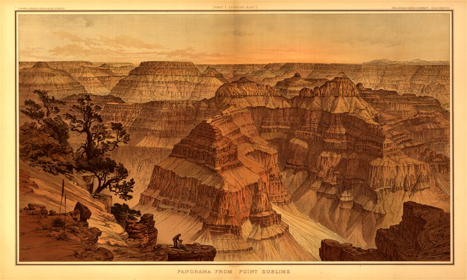
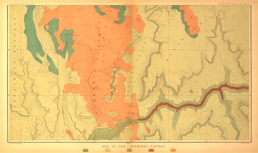
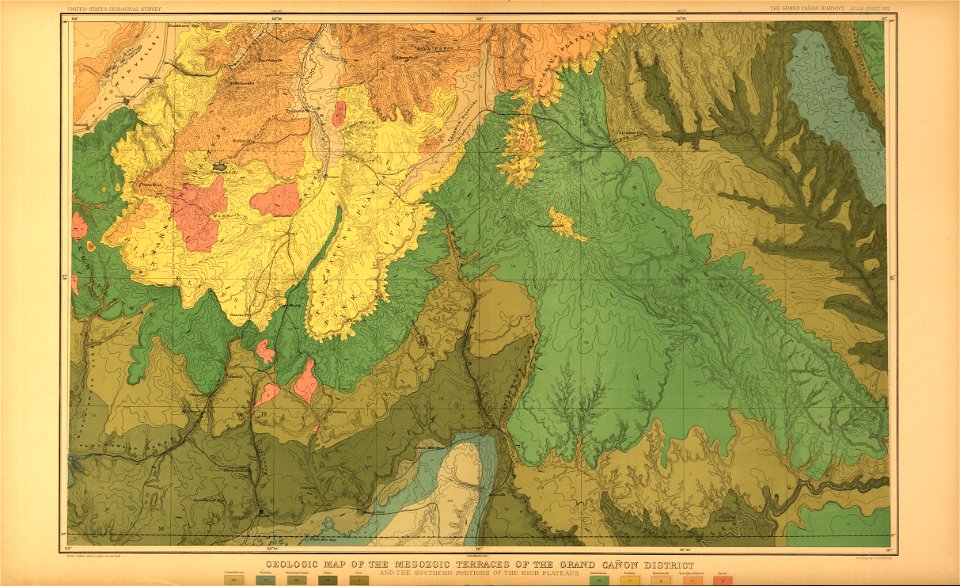
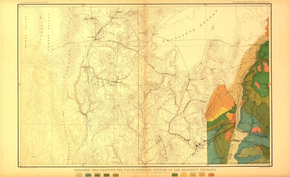
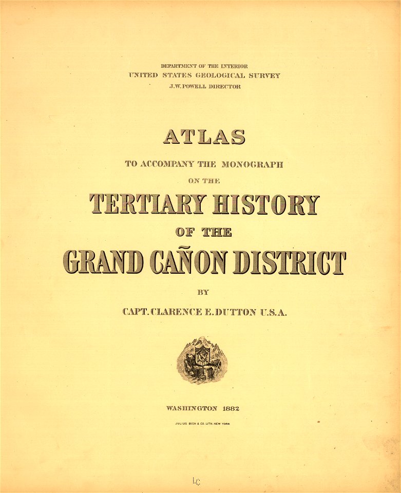
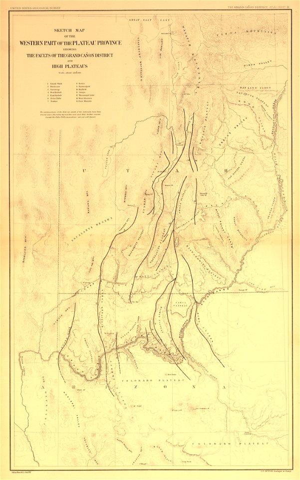
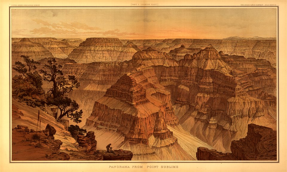
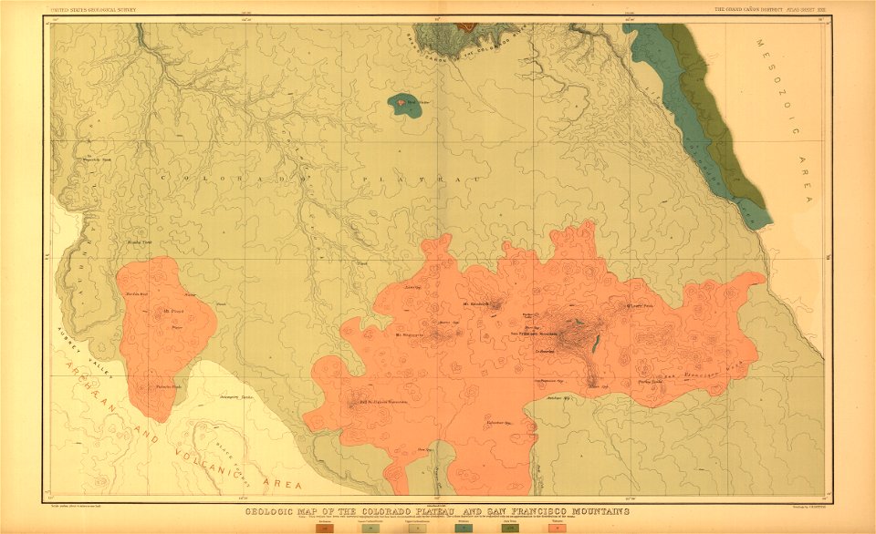
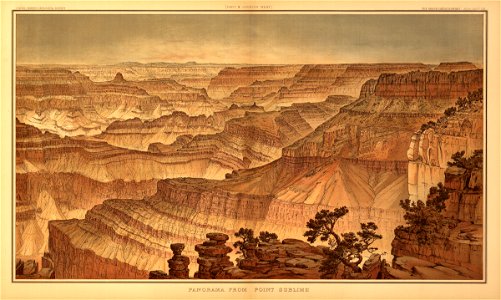
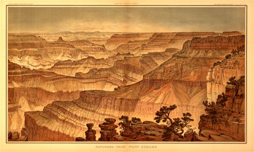
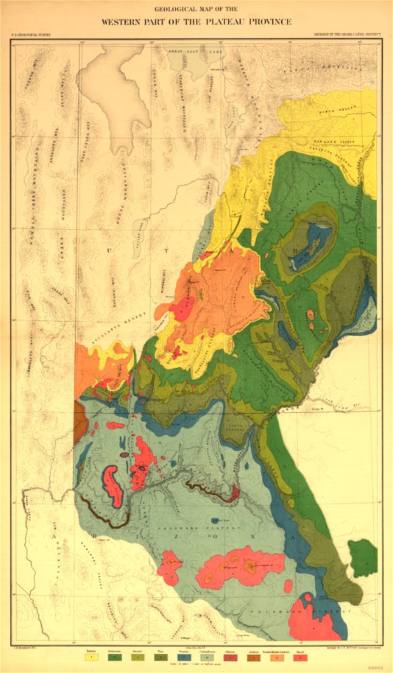
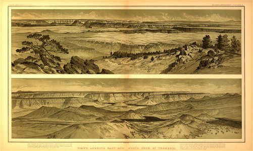
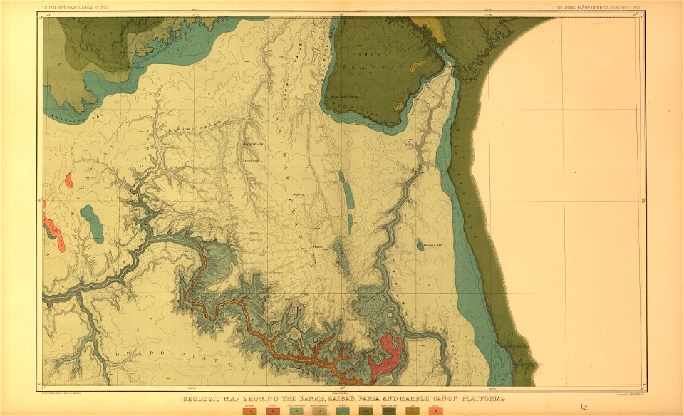
tertiary history of the grand cañon district
..
with atlas
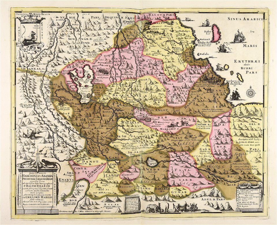
maps made in the 17th century
atlantis magni tomus quintus (biblioteca comunale di trento)
atlas van der hagen
atlantis magni tomus primus (biblioteca comunale di trento)
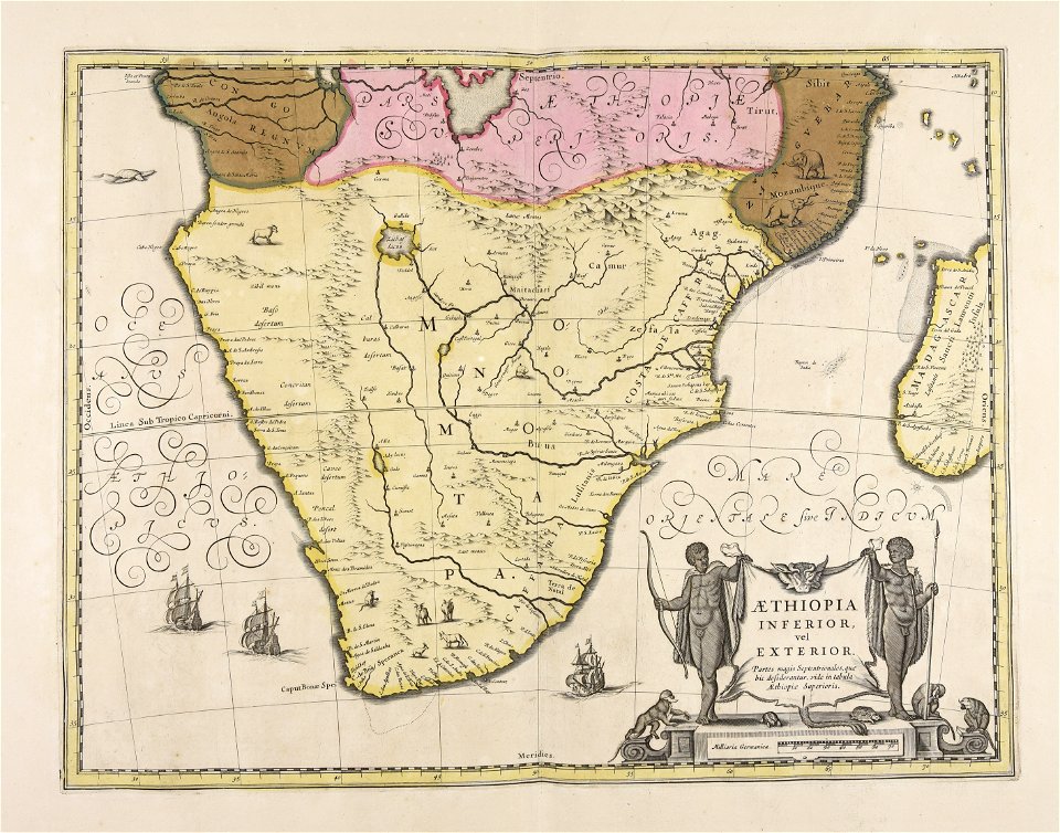
geographical illustrations by coronelli
lithographs of paris
atlantis magni tomus quintus (biblioteca comunale di trento)
maps made in the 17th century
atlantis magni tomus primus (biblioteca comunale di trento)
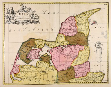
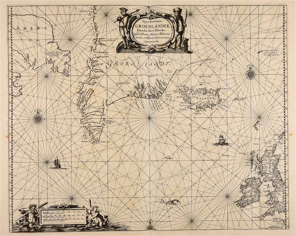
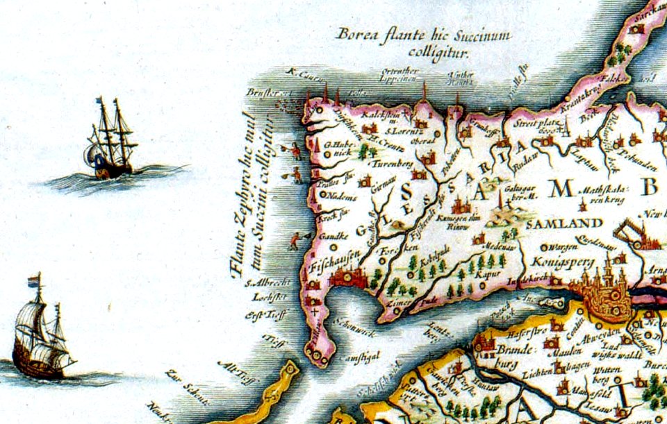
17th-century maps of denmark
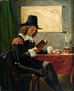
paintings of sitting men reading indoors
1886 paintings
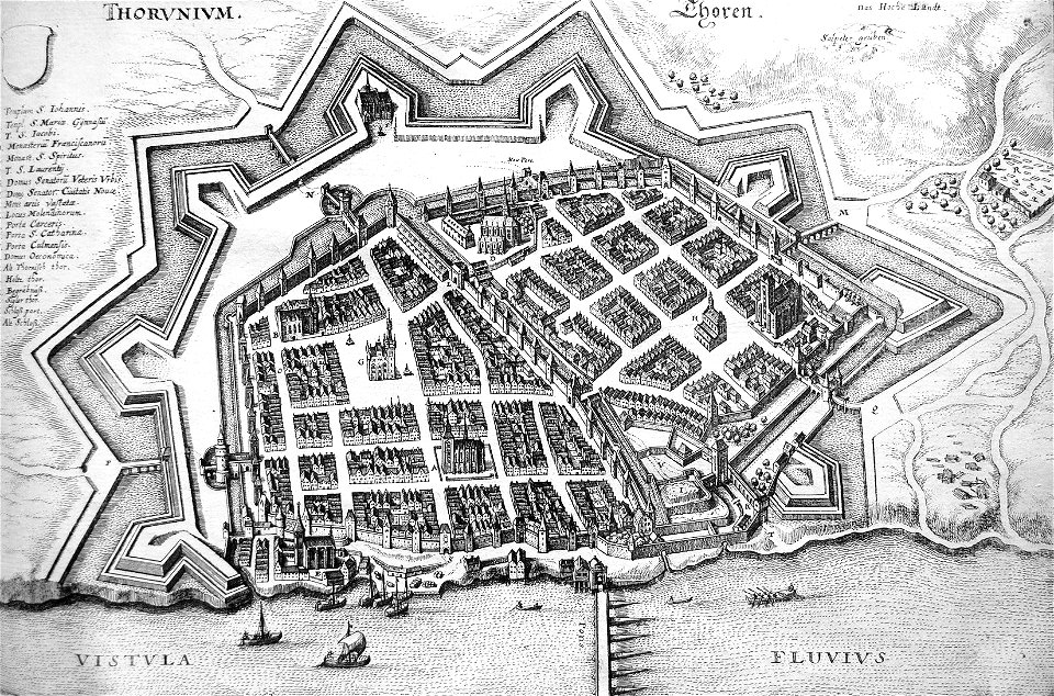
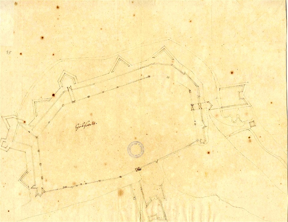
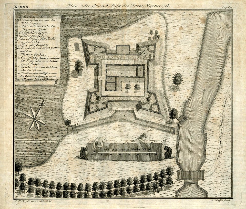
18th-century fortress plans
maps by matthäus seutter
description des principales villes (1690)
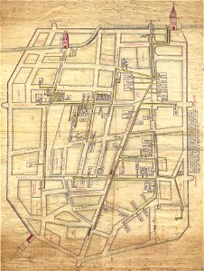
history of nicosia
voyagie door italien
dalmatien
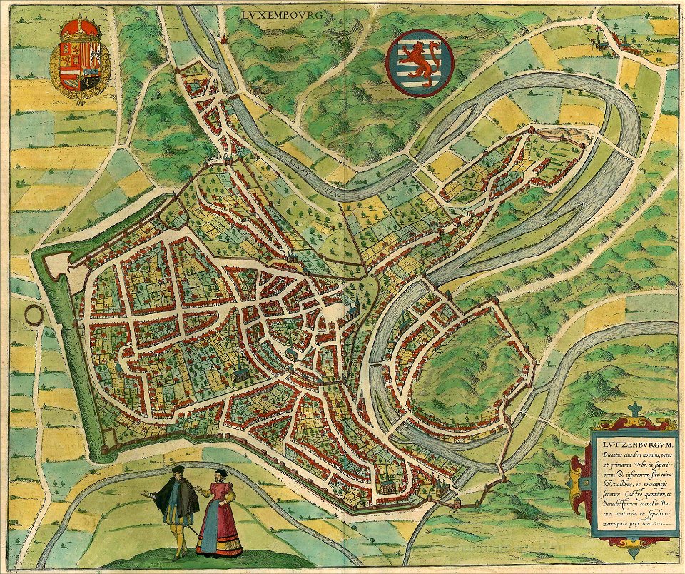
historical maps of lüneburg
1652
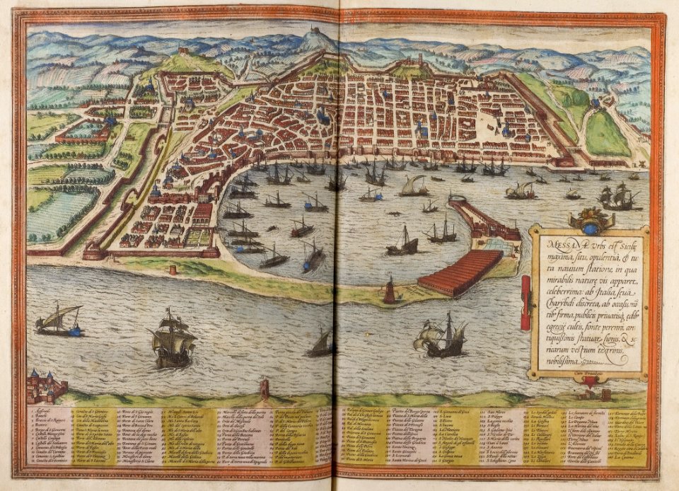
braun & hogenberg
copper engraving
maps made in the 17th century
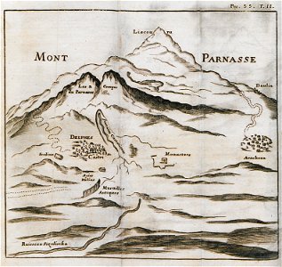
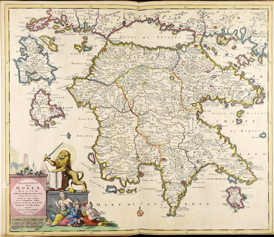
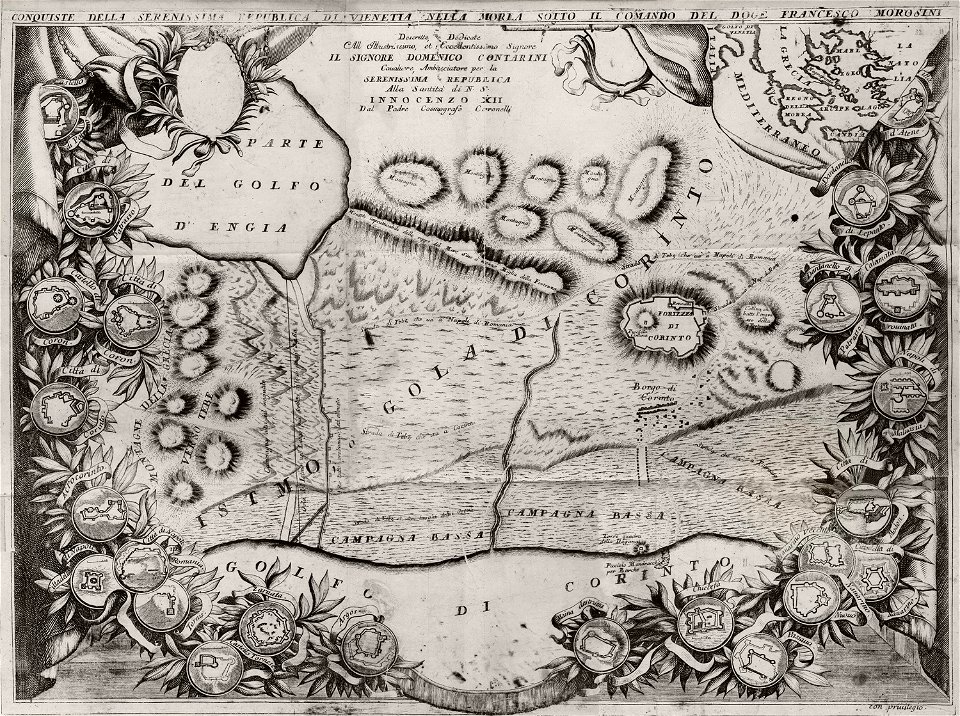
peloponnese
geographical illustrations by coronelli
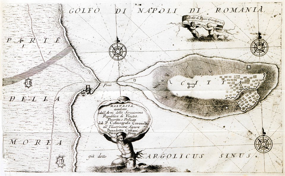
engravings of monemvasia
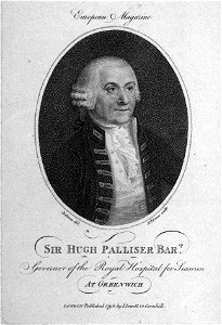
drawings and watercolours of the royal museums greenwich
printing
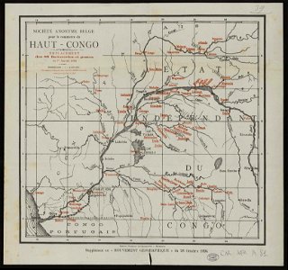
société anonyme belge pour le commerce du haut-congo
maps of the congo free state
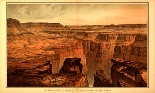
tertiary history of the grand cañon district
maps in the library of congress
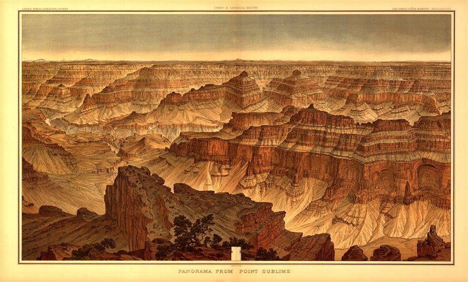
tertiary history of the grand cañon district
maps in the library of congress
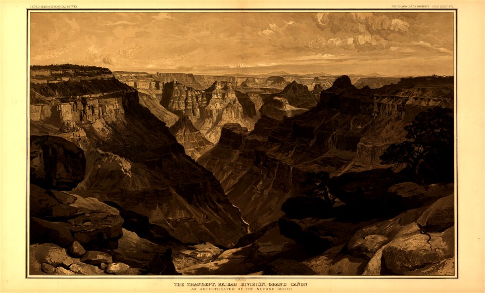
tertiary history of the grand cañon district
maps in the library of congress
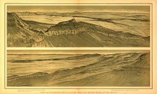
tertiary history of the grand cañon district
maps in the library of congress
tertiary history of the grand cañon district
maps in the library of congress
tertiary history of the grand cañon district
maps in the library of congress
tertiary history of the grand cañon district
maps in the library of congress
tertiary history of the grand cañon district
maps in the library of congress
tertiary history of the grand cañon district
maps in the library of congress
tertiary history of the grand cañon district
maps in the library of congress
tertiary history of the grand cañon district
maps in the library of congress
tertiary history of the grand cañon district
maps in the library of congress
tertiary history of the grand cañon district
maps in the library of congress
tertiary history of the grand cañon district
maps in the library of congress
tertiary history of the grand cañon district
maps in the library of congress
tertiary history of the grand cañon district
maps in the library of congress
tertiary history of the grand cañon district
maps in the library of congress
tertiary history of the grand cañon district
maps in the library of congress
tertiary history of the grand cañon district
maps in the library of congress
tertiary history of the grand cañon district
maps in the library of congress
tertiary history of the grand cañon district
maps in the library of congress
tertiary history of the grand cañon district
maps in the library of congress
tertiary history of the grand cañon district
maps in the library of congress
tertiary history of the grand cañon district
maps in the library of congress
tertiary history of the grand cañon district
maps in the library of congress
tertiary history of the grand cañon district
maps in the library of congress
tertiary history of the grand cañon district
maps in the library of congress
tertiary history of the grand cañon district
maps in the library of congress
tertiary history of the grand cañon district
maps in the library of congress
tertiary history of the grand cañon district
maps in the library of congress
tertiary history of the grand cañon district
maps in the library of congress
tertiary history of the grand cañon district
maps in the library of congress
tertiary history of the grand cañon district
maps in the library of congress
tertiary history of the grand cañon district
maps in the library of congress
tertiary history of the grand cañon district
maps in the library of congress
tertiary history of the grand cañon district
maps in the library of congress
pictorial history of the russian war 1854-5-6 by george dodd
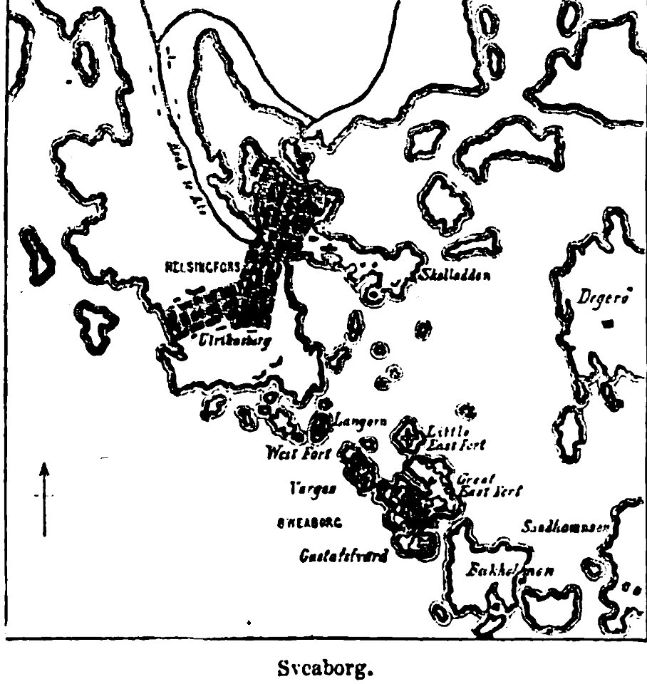
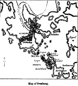
maps of suomenlinna
river transport in the polish-lithuanian commonwealth
engravings by matthäus merian
ämteratlas des fürstentums lüneburg von johannes mellinger
elbe in lower saxony
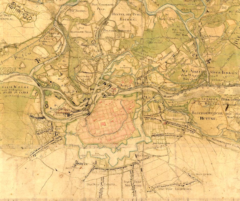
maps of the history of breslau (wrocław)
wrocław in the 16th century
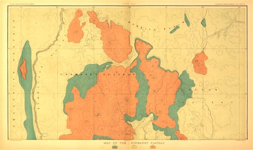
transactions of the geological society of london
vol. 4
atlantis magni tomus quintus (biblioteca comunale di trento)
maps made in the 17th century
atlantis magni tomus primus (biblioteca comunale di trento)
maps made in the 17th century
atlantis magni tomus primus (biblioteca comunale di trento)
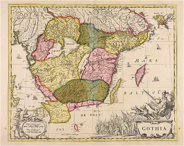
17th-century maps of sweden
pictorial history of the russian war 1854-5-6 by george dodd
maps of suomenlinna
geographical illustrations by coronelli
old maps of the peloponnese
chinese paintings of flowers
jasminum in art
fontaine de la croix du trahoir
tour de nesle
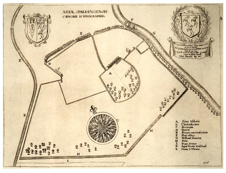
history of spalding
river welland
megalithic temples of malta
old maps of malta
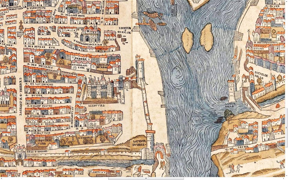
lithographs of paris
floor plans of paris
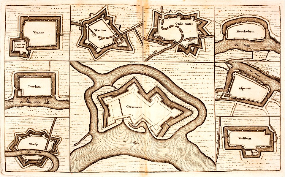
utrecht
leerdam
figure paintings in the national palace museum
wang anshi
1760s maps of the netherlands
old maps of south holland
official portraits (joseon)
yi han-cheol
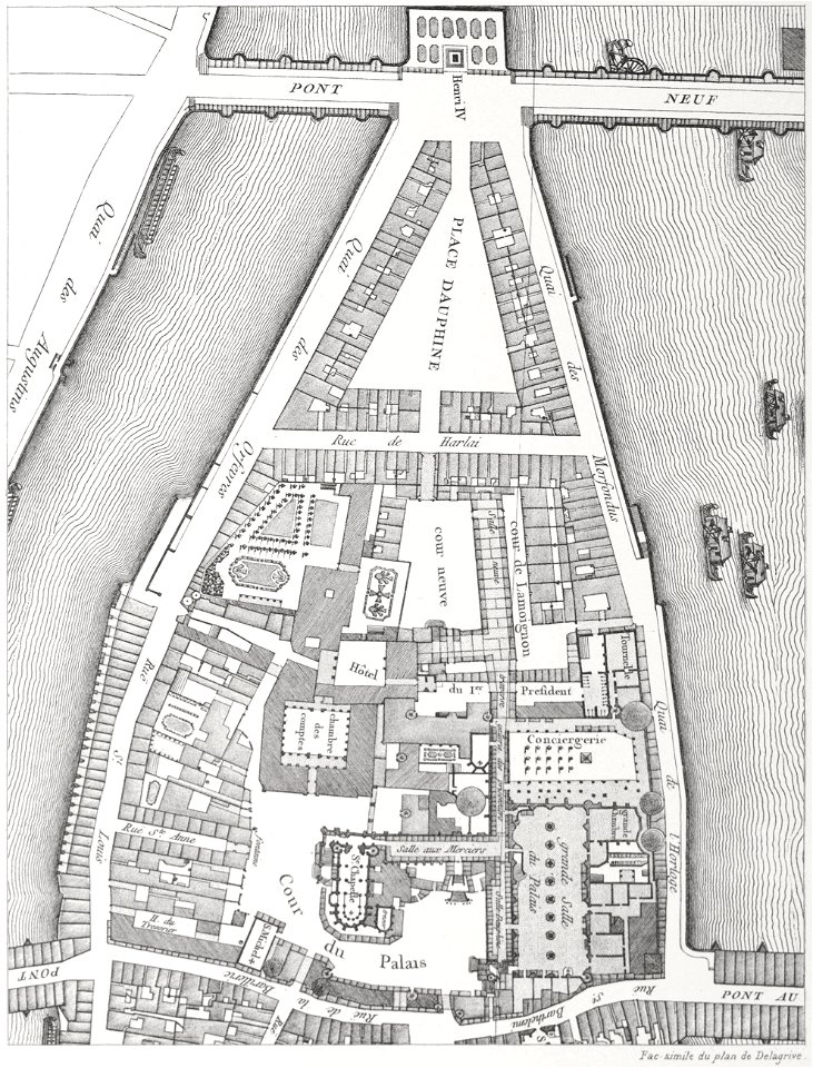
historical images of pont neuf
lithographs of paris
images from metropolitan museum of art (paris project)
1842 in paris
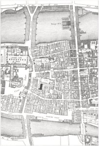
historical images of the pont saint-michel
lithographs of paris
coats of arms of the tsardom of russia
crowned double-headed eagles
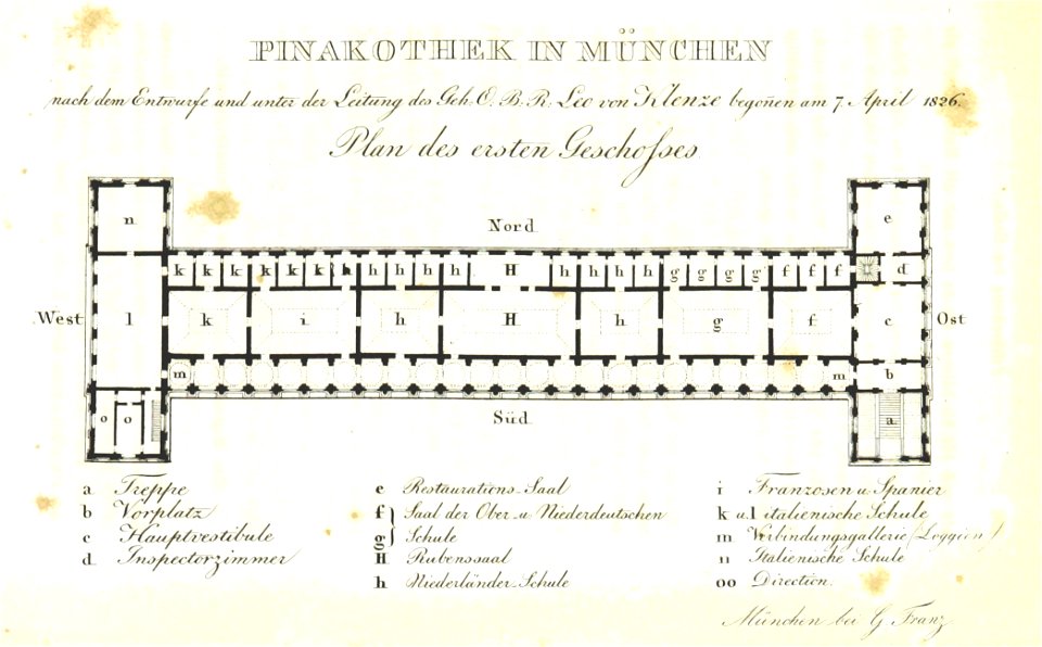
munich in the 19th century
alte pinakothek
cornell university library
gibson girl
austro-hungarian north pole expedition
images of vasárnapi ujság in 1874
prints from selden mare clausum at the peace palace library
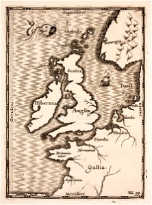
old maps of the british isles
maps of fortifications
arab–khazar wars
atlantis magni tomus secundus (biblioteca comunale di trento)
maps made in the 17th century
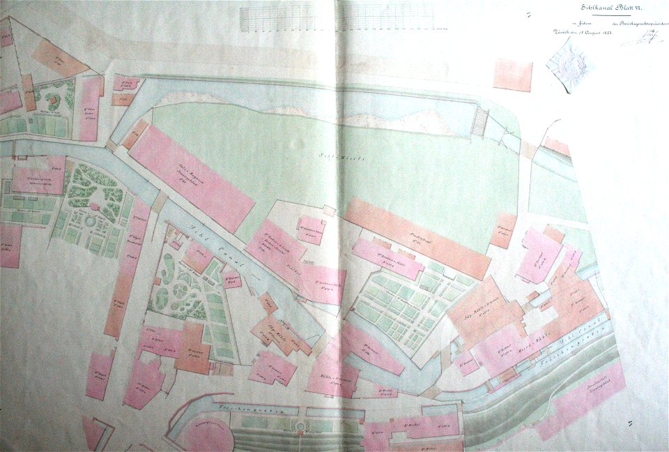
werdmühle (zürich)
zürich
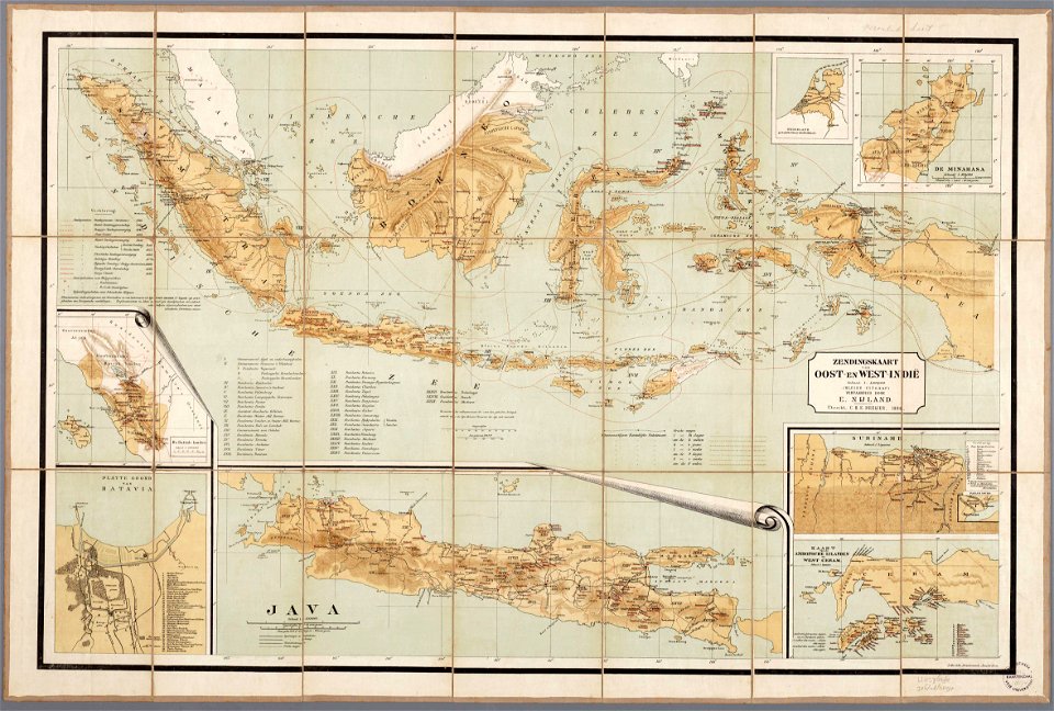
christian mission in south america
christian mission in indonesia
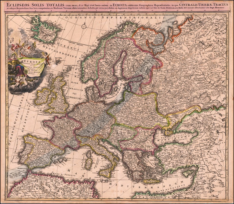
johann baptist homann
1706 maps of europe
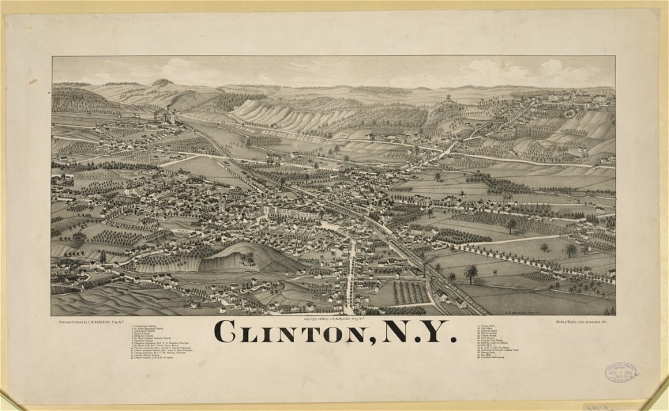
new york
clinton
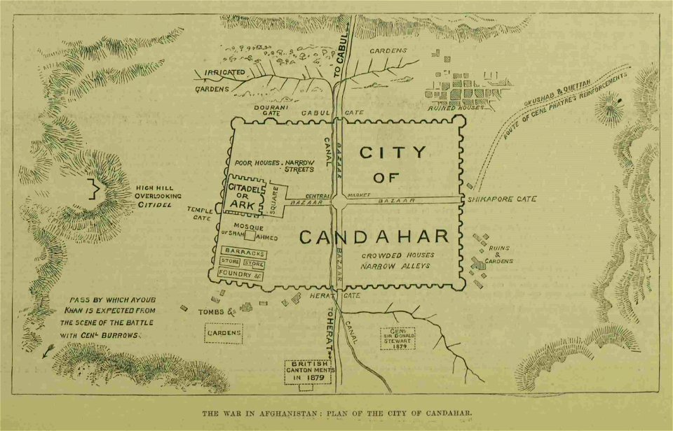
kandahar in the 19th century
battle of kandahar
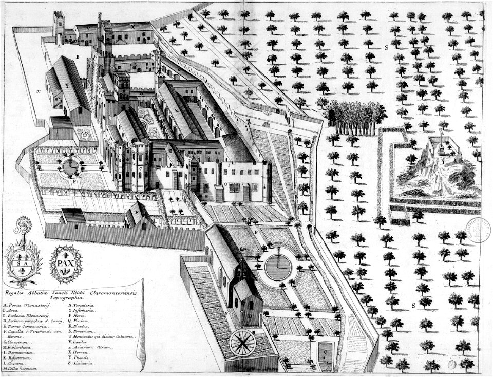
monasticon gallicanum
puy-de-dôme in art
drawings in the universitätsbibliothek salzburg
maps made in the 17th century
geographical illustrations by coronelli
remote views of acrocorinth
drawings and watercolours of the royal museums greenwich
printing
illustrations from second fatherland by george roux
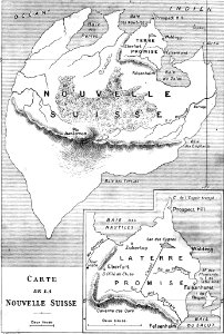
maps of fictional islands
atlas van der hagen
copper engraving
atlas van der hagen
brigittenau
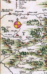
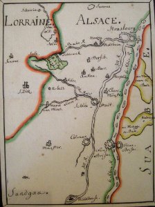
badonviller
blâmont
media contributed by agad presented in former polska.pl portal
maps of the history of breslau (wrocław)
atlantis magni tomus quintus (biblioteca comunale di trento)
maps made in the 17th century
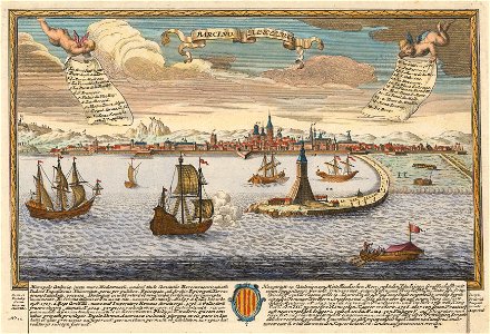
historical images of port of barcelona
maps by joseph friedrich leopold
collections of the musée jean-frédéric oberlin
ban de la roche
braun & hogenberg
historic port
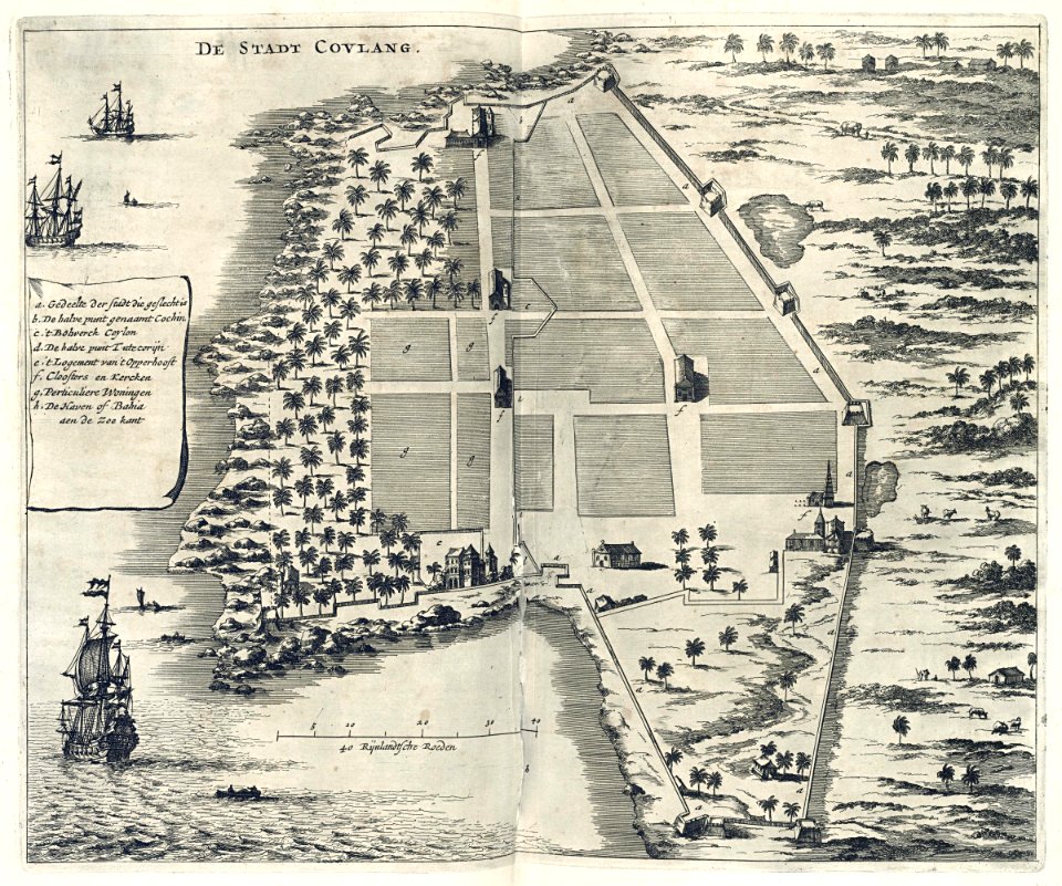
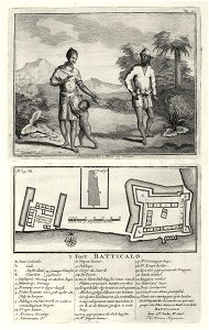
maps of the dutch east india company - india
1672
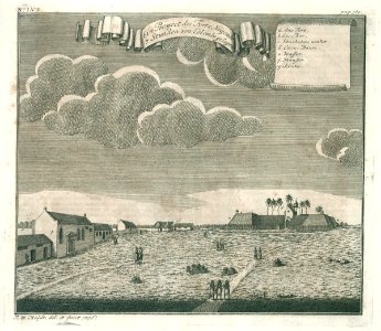
maps of the dutch east india company - indonesia
1739
media from atlas of mutual heritage on dutch east india company
1736
ottomar elliger (ii)
1726
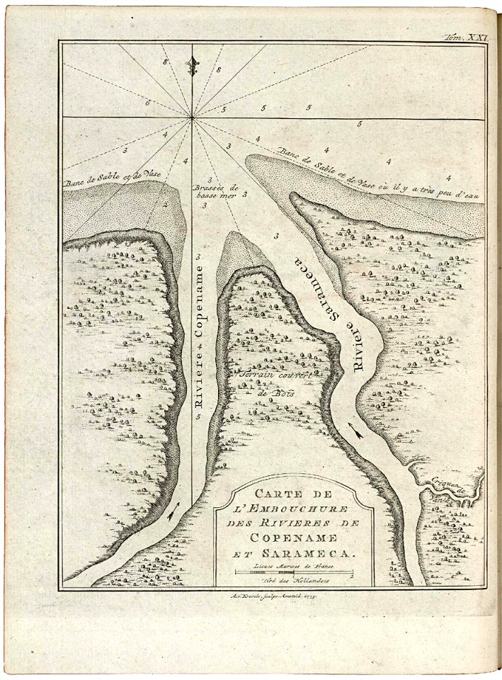
maps of the west-indische compagnie
1773
9401 - 9500 of 35,690
Next page
/ 357